{:es}
Distancia desde Isla Valdecañas (Por autovía): 70 kilómetros Tiempo total para visitarlo: Media jornada
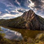
En el centro de la reserva de la biosfera se yergue el parque nacional de Monfragüe, Al,Monfrag que lo llamaran los árabes; el «monte fragoso», una de la joyas nacionales del bosque mediterráneo.
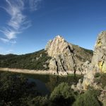
Visitaremos su castillo y conoceremos la populosa vida social de los buitres en Peñafalcón; también un puente cardenalicio, y una villa real fundada para vigilar estas sierras, las mismas que siguen cobijando a las grandes águilas.
Comenzamos nuestro recorrido en Torrejón el Rubio, en cuya oficina de turismo podremos ampliar nuestra información sobre el parque. Desde aquí nos adentramos en la zona protegida cruzando los riberos del arroyo de la Vid con las sierras de Monfragüe y las Corchuelas dominando el horizonte.
Nuestra primera parada la haremos en el aparcamiento habilitado para subir al castillo, al que accederemos a pie para disfrutar de las primeras y puede que las más espectaculares vistas del parque. Seguimos por la carretera de la umbría paralelos al río Tajo hasta el puente que lo cruza, donde se encuentra la fuente del Francés; aguas arriba veremos el puente del Cardenal, semisumergido tras las obras del embalse.
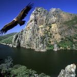
Después a Villarreal de San Carlos, centro neurálgico del parque; aquí podemos visitar los centros de Interpretación de la Naturaleza y del Agua, y ampliar información en el centro de recepción de visitantes. Continuamos nuestra ruta incorporándonos a la carretera de los saltos de Torrejón pasando por el charco del Infierno, un espectacular meandro que forma el río Tiétar, y la fuente de los Tres Caños, hasta llegar a la Tajadilla. Aquí podemos estacionar y usar el observatorio de aves, pues los cantiles al otro lado del río ofrecen buenas posibilidades de ver buitre leonado, alimoche, cigüeña negra… y con suerte águila perdicera.
Continuaremos cruzando la presa pasando por los miradores de la Malavuelta, la Báscula y la Higuerilla, hasta situarnos de nuevo paralelos al río y encontrarnos con un observatorio dedicado a la cigüeña negra, que suele anidar en la otra orilla a pocos metros de aquí.
Después llegaremos a la Portilla del Tiétar, otro de los lugares privilegiados para la observación de aves del parque, en el que es muy probable que tengamos oportunidad de ver a las majestuosas águilas imperiales ibéricas.
Desde la Portilla avanzaremos junto a un bello bosque de umbría, que pronto se transformará en dehesa de alcornoques, algunos fresnos, y encinas, hasta llegar al cruce de la carretera de Serrejón. Allí nos dirigiremos finalmente, observando en este caso la cara norte del parque formada por los relieves de las sierras de Serrejón y la Herguijuela.
Distance from Isla Valdecañas (by highway): 70 kilometres Total visit time: Half a day
In the centre of the biosphere reserve lies the Monfragüe National Park, Al,Monfrag as it was called by the Arabs; «monte fragoso», one of the national jewels of the Mediterranean forest. We shall visit its castle and discover the social lives of the vultures in Peñafalcón.
There is also a red-coloured bridge and a royal villa created to patrol these ranges, the same ones that continue to shelter large eagles.
Our trip begins in Torrejón el Rubio, where the tourism office provides information on the park. From here we enter the protected area, crossing the shores of the Vid stream, with the Monfragüe and Corchuelas mountains dominating the horizon.
Our first stop is made in the parking area that permits access to the castle, which we climb by foot in order to enjoy some spectacular views of the park.
We continue along the road, in parallel to the Tajo River, until reaching a bridge that crosses it, where the Fuente del Francés (Frenchman’s fountain) is located; upstream we see the Cardenal bridge, semi-submerged following the construction of the reservoir.
Then, on to Villarreal de San Carlos, the park’s nerve centre; here we may visit the Nature and Water Information Centres and learn more in the visitor’s reception centre.
We continue along our route, entering the highway from the Torrejón falls and passing by the charco del Infierno (Hell’s pool), a spectacular meander created by the Tiétar River, as well as the fountain of the Tres Caños, until reaching La Tajadilla.
Here we can park and enter the bird observatory, since the cliffs across the river offer good chances of spotting a griffon vulture, Egyptian vulture, black stork… and with luck, a Bonelli’s eagle.
We continue, crossing the dam, passing by the viewpoints of la Malavuelta, la Báscula and la Higuerilla, until again driving in parallel with the river and finding an observatory dedicated to the black stork, which tends to nest on the opposite shore, only metres away.
Then we reach La Portilla del Tiétar, another privileged site for birding, where it is quite possible to spot the majestic Iberian imperial eagles.
From La Portilla we head onward, following a lovely shady forest that soon transforms into pasture-covered plains of cork oaks, ash trees and holm oaks, until reaching the crossing with the Serrejón road. We head in this direction, observing the northern side of the park, outlined by the slopes of the Serrejón and Herguijuela mountains.


